Maps: Tenn and VA and Waterfalls
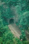
Natural Tunnel, Duffield, VA
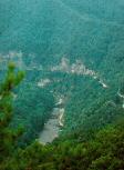
850 foot long tunnel, 100 – 175 feet high. Deep semi-circular basin at south end has vertical walls nearly 400 feet high. Official Virginia DCR – Natural Tunnel Site and Scott County Virginia
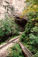
Views of the inside the canyon. Trails around the rim. Short but steep trail down to the canyon floor & tram available to ride up and/or down. ($1.00 each way at this page was published.)
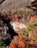
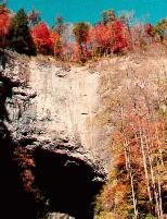
View of the canyon from Scenic Overlook, about 1.2 miles from Lover’s Leap Overlook.
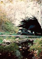
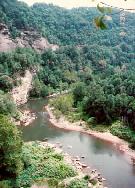
Other end of the tunnel. Half mile hike down Spring Hollow Trail to Stock Creek overlook.
For the really dedicated runner (nuts works too) , The Natural Tunnel hosts a road/trail race in late April. A 3.7 mile run starting at the picnic area and going up around the rim of the canyon to near Lover’s leap and back down into the picnic area. The course features 2 sets of steps, the second set is part of a series of switchbacks. Winning men’s times are about 22 minutes or so. For more info, contact the Scott County Chamber of Commerce.
Cumberland Gap National Historical Park
More info about the Cumberland Gap & The National Park Service

Above are the markers at the peak of Tri-peaks, marking the location where Virginia, Tennessee & Kentucky meet. Hey, wait a minute — it looks like Carmen has stolen the panel for Tennessee!
Quick — call the Acme CrimeNet!

If you die on the state line, which state does the autopsy?
Cumberland Valley
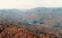
The Breaks Interstate Park, VA/KY Stateline.
Largest canyon east of the Mississippi River. Five miles long with sheer vertical walls 1600 feet high.
Official Kentucky Breaks site.
Falls at Stoney Creek, Hanging Rock Rec. Area
near Dungannon, VA
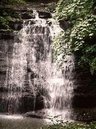
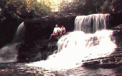
Lower Falls
Park at Hanging Rock and hike 2 – 3 miles up stream (easy to moderate) or cheat & drive over forest roads to an upper parking area. From the upper parking area, it’s just a short distance down stream to the upper falls and not too far to the lower falls.
Upper Falls
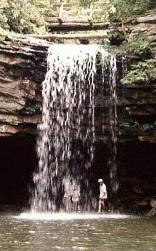
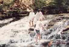
If you hike upstream there are several small waterfalls & cascades. There are several fun, safe places for kids to play in the stream. A smaller, less used trail breaks off the main trail near a bridge below the lower falls & follows a small stream to another couple of falls.
Consult a good map for exact directions to the upper parking area. Basically, you continue past the Hanging Rock area, towards Coburn. When you come to a little town, you turn left twice, soon you lose pavement. The forest service has some signs posted on the dirt road. If you miss the turn to Stoney Creek Falls, you’ll have a nice drive through the Jefferson National forest & end up around Bark Camp Lake — a nice place to visit also.
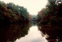
Stoney Creek, near Hanging Rock
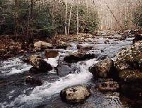
What you’ll miss if you don’t hike upstream.
Hungry Mother State Park, Marion VA
Molly Knob elev. 3270
Hiking, picnicking, boating. Official
Virginia Hungry Mother site.

“Lookin’ at fish hidin’ under the bridge, Mom”
Lake at Hungry Mother SP
More information on Virginia or Kentucky state parks.