The Poremsky Family
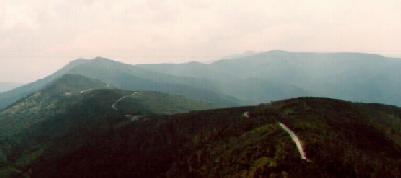
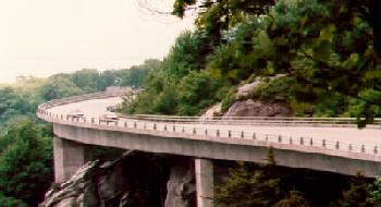
Blue Ridge Parkway
Blue Ridge Parkway
One of our favorite places in this area is the Blue Ridge Parkway. We like to explore from Boone, NC south to Waynesville, NC.
Maps & sights to see on the Parkway:
VA/NC state line
south to Boone ![]() NC Boone to Asheville
NC Boone to Asheville
![]() Asheville to Smokey Mountains
Asheville to Smokey Mountains
![]() Many of the most interesting places to stop
at are in this half of the parkway.
Many of the most interesting places to stop
at are in this half of the parkway.
![]() Mile markers shown in black numbers on the
maps. The VA/NC state line is at 219. Blowing Rock is near mile 290. Asheville is near
miles 380 to 390,
Mile markers shown in black numbers on the
maps. The VA/NC state line is at 219. Blowing Rock is near mile 290. Asheville is near
miles 380 to 390,
![]() Speed limit 45 MPH.
Speed limit 45 MPH.
![]() Parking along side of the Parkway is
permitted, when done in a safe manner.
Parking along side of the Parkway is
permitted, when done in a safe manner.
![]() No fees (tolls) charged for traveling the
Parkway & no fees charged to visit most, if not all, sites along the Parkway.
No fees (tolls) charged for traveling the
Parkway & no fees charged to visit most, if not all, sites along the Parkway.
![]() Camping permitted in designated campgrounds
only (fees charged).
Camping permitted in designated campgrounds
only (fees charged).
![]() National Park Service maps available free
at Visitor's Centers.
National Park Service maps available free
at Visitor's Centers.
![]() Most park services available from May 1 to
Oct 1, parkway open all year, but some sections may be closed in winter due to ice or
snow.
Most park services available from May 1 to
Oct 1, parkway open all year, but some sections may be closed in winter due to ice or
snow.
Area Day Trips
Blue Ridge Parkway
Other Places
Recommended travel guides include a 2-part guide by William Lord, "Blue Ridge Parkway Guide". Part 1 coves the northern part, stopping near Boone, NC. Part 2 covers Boone south to the Smokey's. (About $6.00 each.